
Runoff Impact on Old Wagon Trail Road to Mohave Lake View Ranchos: The Growing Concern Over Mining Exploration
By Pat | Lake Mohave Sports Guide
Old Wagon Trail Road Mining Exploration Runoff Load: A Concern Close to Home
There's something special about waking up at Casa Codorniz, pouring a cup of coffee, and watching the first sunlight creep across the Black Mountains above Lake Mohave.
The desert is quiet.
The Gambel's quail are beginning to stir.
A raven may be circling overhead.
And beyond the rocky ridges to the west lies that magnificent blue ribbon of Colorado River water winding through the mountains of Arizona and Nevada.
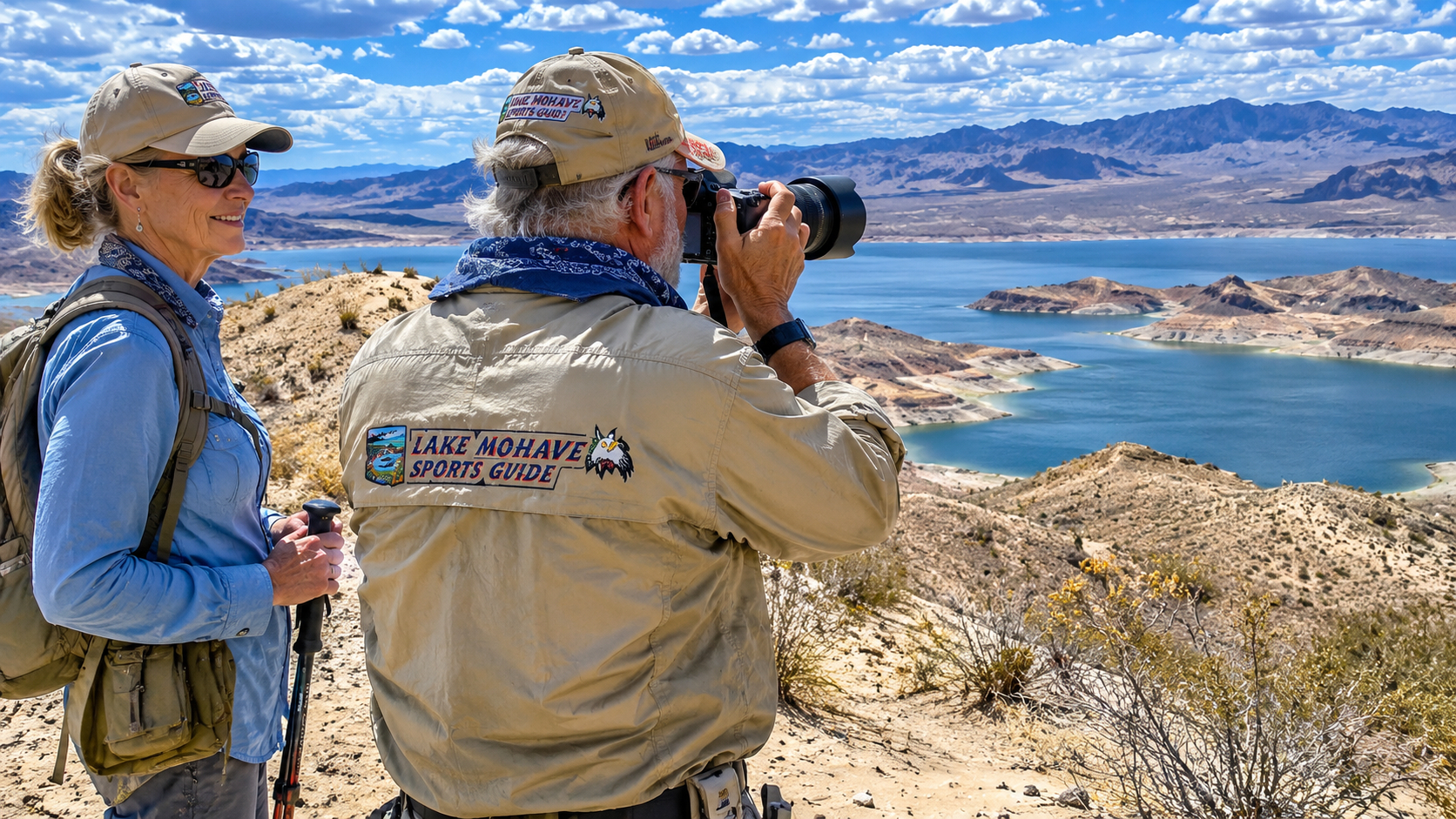
Paulette and I have been fortunate to call this country our winter home for nearly fifteen years.
She named our property High Chaparral, and we hung a carved wooden sign from the old ranch-style front gate.
I call it Casa Codorniz, after the Gambel's quail that share our little corner of the desert.
Either name suits me just fine.
But lately, when I look across the surrounding desert, I find myself thinking about something considerably less pleasant than quail, beautiful mountains, and smallmouth bass.
Mining exploration.
More specifically, the expanding network of graded roads and widened trails associated with mineral exploration around Mohave Lake View Ranchos.
Now, I want to make something clear right from the beginning.
I'm not opposed to mining.
I grew up on cattle ranches in the Kansas Flint Hills, spent years flying airplanes, and operated a construction business for seventeen years.
I understand the importance of natural resources, private enterprise, and the hard work required to build something worthwhile.
But I also understand that disturbing the land has consequences.
And in the Arizona desert, those consequences can become painfully obvious after a heavy rain.
My concern is that the widening of long-established two-track trails and construction of new access roads may increase runoff, erosion, and sediment deposits along Old Wagon Trail Road.
That's not simply an inconvenience.
Old Wagon Trail Road is our principal route between Mohave Lake View Ranchos and Bullhead City.
We depend on it for groceries, deliveries, medical access, emergency services, and fire protection.
If that road becomes impassable after a storm, the consequences could be serious.
And after what I've witnessed recently, I believe the question deserves more attention than it's receiving.
November 6: A Look at the Changing Desert
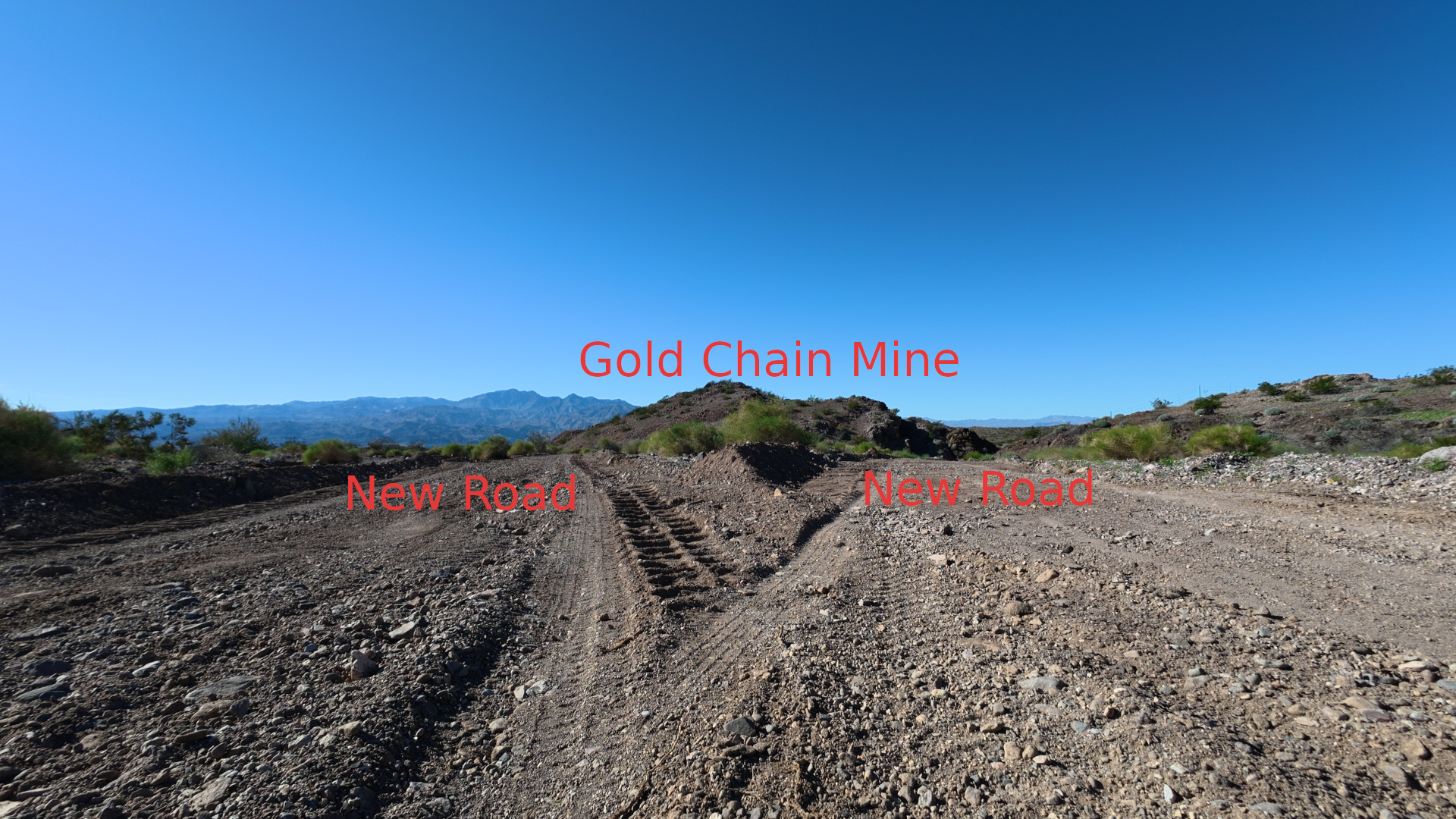
On November 6, neighbors told me that existing Bureau of Land Management two-track routes were being widened and that entirely new roads were being graded in the surrounding country.
Naturally, I was curious.
And concerned.
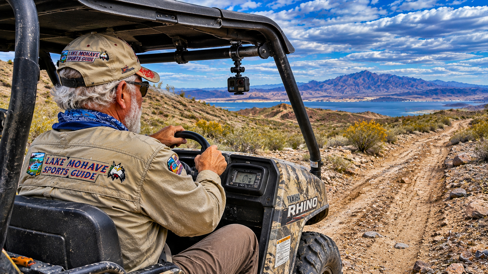
I've been exploring these mountains and desert trails for years in my Yamaha Rhino.
I know many of the old routes.
Some are little more than two narrow tire tracks winding through the creosote bushes.
Others follow old mining roads or natural contours around the hills.
They're part of the character of this country.
A narrow trail allows access without unnecessarily disturbing the surrounding desert.
But widening those trails can change the landscape dramatically.
So I gathered my video equipment and headed out to document what was happening.
One of the routes that attracted my attention runs between Mohave Lake View Ranchos and Katherine Mine Road.
I believe it's designated BLM Route 7864, although that route number should be confirmed against the current BLM travel-management map.
The section I was interested in was approximately 1.2 kilometers long.
That's roughly three-quarters of a mile.
Not a tremendous distance.
But a road doesn't have to be long to create a problem when it crosses steep desert terrain and drains toward an existing roadway.
I recorded the grading and disturbed ground so I would have a visual record of the conditions.
I wasn't conducting an engineering survey.
I wasn't measuring soil compaction.
And I wasn't determining who had authorized the work.
I was doing what I've spent much of my retirement doing.
Observing the country.
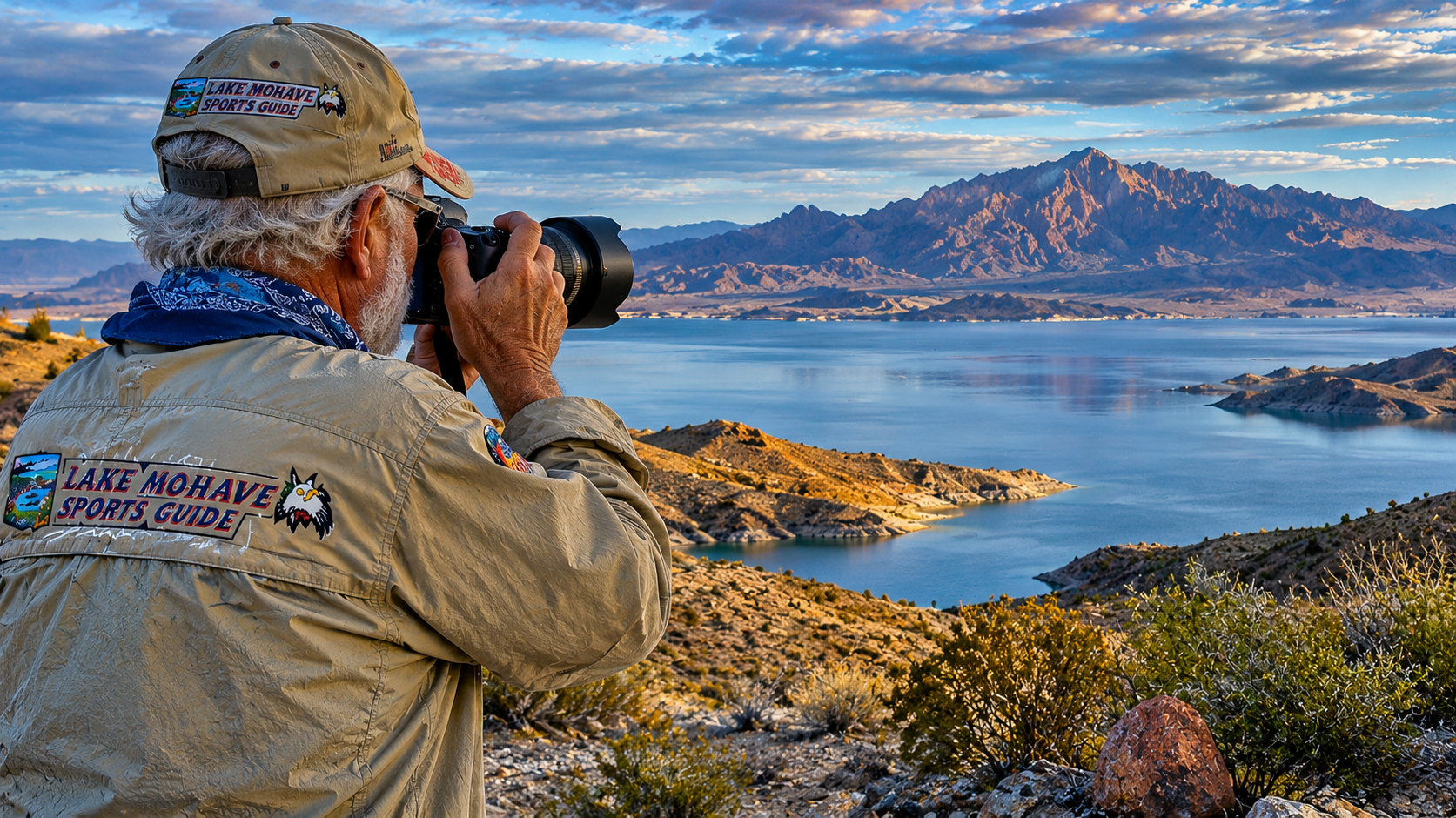
Photographing it.
Recording video.
And trying to understand the changes taking place around us.
Is West Point Gold Responsible for the Road Work?
West Point Gold's expanding exploration activities in the Gold Chain district have raised concerns among some residents of Mohave Lake View Ranchos.
However, an important distinction must be made.
The presence of grading near a mining exploration project does not, by itself, establish that West Point Gold performed, contracted, or authorized every instance of road construction.
Determining responsibility requires examining the relevant BLM authorizations, exploration plans, contractor records, and land-management boundaries.
Likewise, an existing BLM route may be open for certain uses without authorizing unrestricted widening or new construction.
I believe residents deserve to know exactly which roads are being modified, who is responsible, what permits apply, and what erosion-control measures are required.
Those are reasonable questions for any operation working near an established rural community.
Why Old Wagon Trail Road Matters to Our Community
Old Wagon Trail Road isn't just another dirt trail winding into the desert.
It's an essential access route.
For Paulette and me, it's the road we depend on when traveling between Casa Codorniz and Bullhead City.
When we need groceries, supplies, medical care, or services, we use that route.
When a delivery truck brings equipment to our property, road conditions matter.
And should we ever need emergency medical assistance or fire protection, safe access could become critically important.
I learned the importance of reliable roads growing up on ranches.
A washed-out crossing could delay a cattle truck.
A muddy ranch road could leave equipment stranded.
And a flooded creek could isolate an entire pasture.
But the stakes become considerably higher when an emergency vehicle needs to reach someone's home.
In our desert community, many residents are retired.
Some are elderly.
Others live alone.
And many properties are separated by considerable distances.
A road closure that might be a minor inconvenience in town can become a serious problem out here.
That's why I became particularly interested in the potential runoff from the newly graded trail near Old Wagon Trail Road.
The question wasn't simply whether the grading looked unattractive.
It was whether the altered surface could change the amount, direction, or concentration of stormwater reaching our main road.
The Question I Asked Artificial Intelligence
After examining the newly graded route, I decided to ask AI for a preliminary assessment.
My question was:
What is the estimated runoff load from 1.2 km of newly graded two-track trail near the intersection of Old Wagon Trail Road, recently labeled Grasshopper Road on Google Maps?
I supplied two geographic coordinates identifying the general route and the road intersection.
What I wanted to understand was whether grading approximately three-quarters of a mile of desert trail could create a meaningful increase in stormwater runoff.
Unfortunately, the table in the response I saved contained no usable numerical results.
So rather than repeat figures that weren't actually provided, I decided to examine the problem using a transparent set of assumptions.
That distinction matters.
An AI-generated number can look impressively precise.
But unless the underlying assumptions are correct, it's only arithmetic dressed up as engineering.
And when we're discussing roads, erosion, and public safety, arithmetic alone isn't enough.
How Much Runoff Could a Newly Graded 1.2-Kilometer Trail Produce?
Here's where things get interesting.
The amount of runoff from a graded road depends on several factors.
The length and width of the disturbed surface.
The intensity and duration of rainfall.
The slope.
The type of soil.
How compacted the road becomes.
Whether water can drain naturally across the landscape.
And whether grading has created berms or channels that concentrate runoff.
A narrow, established two-track trail may allow much of the rainfall to soak into the surrounding ground or disperse between undisturbed patches of vegetation.
A wider, compacted road may shed more water.
But the biggest problem often isn't simply the amount of water.
It's where that water goes.
A poorly designed road can collect runoff from a much larger hillside and deliver it to a single location.
That concentrated flow can cut gullies, transport sediment, and deposit debris across a road downhill.
An Illustrative Runoff Calculation
Let's begin with the approximately 1,200-meter section of trail I documented.
For this example, I'll assume the graded road is six meters wide, or about twenty feet.
That's an assumption, not a surveyed measurement.
The disturbed surface would cover:
1,200 meters × 6 meters = 7,200 square meters.
That's approximately 1.78 acres.
Now let's consider three hypothetical rainstorms.
|
Rainfall |
Rain falling directly on road |
Illustrative runoff at 70% |
|---|---|---|
|
1 inch (25.4 mm) |
183 m³ |
128 m³ |
|
2 inches (50.8 mm) |
366 m³ |
256 m³ |
|
3 inches (76.2 mm) |
549 m³ |
384 m³ |
The runoff coefficient of 70% is a hypothetical assumption representing a relatively runoff-prone surface. Actual runoff could be substantially lower or higher depending on conditions.
For those of us who grew up measuring water in gallons, the middle example works out to approximately 67,600 gallons of runoff.
ILLUSTRATIVE TWO-INCH RAINSTORM
67,600 gallons
Estimated runoff from a hypothetical 1.2-km-long, 20-foot-wide compacted road at a 70% runoff coefficient.
That's a lot of water.
But there's a very important qualification.
This is the total modeled runoff from the road surface, not the additional runoff caused by widening the road.
Some water would have run off the original trail or natural ground anyway.
To calculate the actual increase, we'd need to compare the newly graded condition with the original surface.
We'd also need to determine how much water enters from the surrounding hillside.
And that could be far more important than rainfall falling directly on the road.
What If the Road Collects Runoff From the Hillside?
Imagine a hillside draining toward a newly graded road.
Before construction, stormwater might have flowed through several small natural channels.
Vegetation, rocks, and uneven terrain would have slowed and dispersed some of that flow.
Now imagine a grader cuts into the slope and leaves a continuous berm along the downhill edge.
Rainwater flowing from the hillside may become trapped against that berm.
Instead of crossing the road and continuing through its natural drainage, it begins traveling along the road.
As more water enters, the flow becomes deeper and faster.
Eventually, it reaches a low point, an intersection, or a break in the berm.
Then all that collected water may discharge at once.
That is the situation I'm particularly concerned about near Old Wagon Trail Road.
A relatively small increase in total runoff can still create a much larger local erosion problem if the water is concentrated into a narrow channel.
And the reverse is also true.
Properly designed drainage can sometimes prevent severe erosion even where roads have been widened.
The important issue is whether the road has been engineered to handle the stormwater it receives.
How Much Sediment Could Reach Old Wagon Trail Road?
This is the question that really matters to residents.
Unfortunately, sediment loads are much more difficult to estimate than water volumes.
Rainfall-runoff calculations tell us approximately how much water might move across a surface.
They don't tell us how much soil that water will carry.
Sediment transport depends on soil characteristics, slope, vegetation, road grading, flow velocity, channel erosion, and the amount of loose material available.
Fresh grading can expose soil and rock that were previously protected by a crust, vegetation, or compacted surface.
Heavy equipment may also leave loose material along road edges.
When a storm arrives, some of that material can be washed downhill.
But a responsible sediment-load estimate would require field measurements.
For example, investigators could measure sediment deposits after storms, establish cross sections of drainage channels, and compare conditions before and after road construction.
They could also use established erosion and hydrologic models.
Without that information, claiming that a particular road will deposit hundreds of tons of sediment on Old Wagon Trail Road would be speculation.
I don't want speculation.
I want answers.
What Measurements Would Help?
I'd like to see a qualified engineer or hydrologist examine the following:
-
The actual width and length of the graded road.
-
The original and current drainage patterns.
-
The size and slope of the watershed draining toward the road.
-
Existing berms, culverts, water bars, and drainage crossings.
-
Soil type and erosion susceptibility.
-
Expected runoff during common and severe thunderstorms.
-
Locations where concentrated flow could reach Old Wagon Trail Road.
-
Measures needed to prevent sediment from blocking residential access.
A survey of the road before the next major storm would be particularly valuable.
Once a flood rearranges the landscape, it becomes more difficult to distinguish preexisting conditions from new damage.
What Does the BLM Say About Mining Exploration Roads?
I was interested to discover that the Bureau of Land Management has specific regulations governing surface disturbance associated with mineral exploration.
Under 43 CFR Part 3809, exploration activities that exceed casual use generally require a notice or an approved plan of operations, depending on the activity and land status.
BLM regulations also establish performance standards intended to prevent unnecessary or undue degradation.
Access roads are supposed to be designed with consideration for the terrain, operational needs, and environmental effects.
And mining operators may be required to reclaim disturbed areas.
The BLM explains that a notice generally applies to qualifying exploration disturbing five acres or less, while a plan of operations is required for larger operations and certain activities on special-status lands.
Bureau of Land Management+1
The Gold Chain Project Has an Official BLM Record
One particularly important discovery is that the BLM maintains an official environmental review record for the Gold Chain Mining Project.
The project is identified as:
DOI-BLM-AZ-C010-2026-0007-EA
The BLM describes West Point Gold Corporation's proposal as involving up to three acres of surface disturbance for mineral exploration approximately eight miles northeast of Bullhead City.
The project lies within the Black Mountains Ecosystem Management Area of Critical Environmental Concern.
The BLM project record lists a March 17, 2026 decision and completed environmental assessment process.
BLM National NEPA Register
That's important information.
It confirms that West Point Gold has a documented exploration proposal subject to federal review.
But it doesn't establish that the particular 1.2-kilometer route I observed is included in that authorization.
Nor does it establish that all nearby grading is attributable to the company.
Those questions require comparing the actual road locations with the approved project maps and any other applicable authorizations.
For residents, the most useful starting point is the BLM Gold Chain Mining Project record.
What I'd Like to Know From the BLM
I believe the Kingman Field Office should be able to help residents establish several basic facts.
Is the route I documented officially designated BLM Route 7864?
Was its widening authorized?
Was new road construction approved?
Which operator performed the work?
What drainage and erosion-control requirements apply?
Were the potential effects on Old Wagon Trail Road and nearby residential properties evaluated?
And what measures will be required if grading causes increased runoff or sediment deposits?
I don't consider those unreasonable questions.
They're exactly the sort of questions public-land management is supposed to address.
When a Mining Road Becomes a Community Safety Issue
There's another consideration that concerns me even more than the visual impact.
Fire protection.
Anyone who has lived in the desert understands how quickly a fire can become dangerous.
Vegetation may be sparse compared with a mountain forest, but desert grasses, shrubs, and other fuels can burn under the right conditions.
Strong winds can make a difficult situation worse.
If emergency equipment needs to reach a remote property, road conditions matter.
An ambulance cannot help somebody if it can't reach the house.
A fire truck cannot protect a structure if the access road is buried in mud and rock.
And residents cannot evacuate safely if their principal route becomes impassable.
This is why I believe the drainage consequences of exploration roads should be evaluated before major grading occurs.
Once a storm has washed out the road, the opportunity for prevention has already passed.
The Desert Isn't Empty Land
One thing I've noticed over the years is that people unfamiliar with the desert sometimes assume there's very little living out here.
A few rocks.
Some creosote bushes.
A cactus here and there.
And miles of open ground.
But that view misses an extraordinary amount of life.
Around Casa Codorniz, we enjoy watching Gambel's quail, ravens, coyotes, jackrabbits, and numerous other desert creatures.
The surrounding Black Mountains provide habitat for desert bighorn sheep.
Other areas support reptiles, small mammals, and birds adapted to this harsh environment.
And in suitable habitat, the Mojave desert tortoise deserves particular protection.
Many desert plants grow slowly.
Soil crusts can take years to recover after disturbance.
Vehicle tracks may remain visible long after the machinery has departed.
Widening a road doesn't simply remove a few feet of vegetation.
It can fragment habitat, alter drainage, increase dust, and create opportunities for additional unauthorized vehicle travel.
Arizona Game and Fish encourages responsible OHV use because remaining on authorized routes helps protect wildlife habitat and prevent unnecessary damage to the landscape.
I enjoy exploring this country in my Yamaha Rhino.
But I don't believe my enjoyment gives me the right to create a new trail wherever I please.
The same principle should apply to everyone using public land.
Why Runoff Matters to the Colorado River and Lake Mohave
The Colorado River has been part of my life for many years.
I've fished its reservoirs.
Photographed its canyons.
Explored its shorelines.
And spent countless hours enjoying its wildlife.
Lake Mohave is particularly special.
The reservoir extends approximately 64 miles between Hoover Dam and Davis Dam and covers roughly 30,000 acres at typical operating levels.
Its upper section lies within the narrow walls of Black Canyon, where deep releases from Hoover Dam maintain relatively cold water.
Farther south, the reservoir opens into broad basins and rocky coves.
The principal inflow is the Colorado River, supplemented locally by intermittent desert washes.
Water levels fluctuate with reservoir operations and downstream water deliveries.
The Nevada Department of Wildlife notes that Lake Mohave may experience fluctuations of approximately 15 to 20 feet.
Nevada Department of Wildlife %
Those fluctuations, combined with seasonal storms, influence shoreline conditions, access, and aquatic habitat.
Does Runoff From Old Wagon Trail Road Reach Lake Mohave?
That's a question requiring a watershed analysis.
Water draining from the Black Mountains may eventually enter washes connected to Lake Mohave or the Colorado River.
But not every sediment deposit travels all the way to the reservoir.
Some material settles in upland washes.
Some accumulates behind vegetation or road embankments.
Some remains on roads until removed.
And finer material may travel farther during large storms.
Without mapping the drainage network and measuring sediment transport, I can't say how much material from the newly graded route will reach the lake.
But I can say that preventing unnecessary erosion uphill is preferable to dealing with its consequences downstream.
Why Should Anglers Care About Sediment?
Lake Mohave supports largemouth bass, smallmouth bass, striped bass, rainbow trout, channel catfish, bluegill, and other fish.
It also supports native fish conservation efforts, including razorback suckers and bonytail chub.
The National Park Service emphasizes the protection of these native species and asks anglers to release and report accidental catches.
National Park Service
As a lifelong bass fisherman, I understand how important underwater habitat is.
Smallmouth bass frequently use rocky points, gravel areas, and submerged ledges.
Largemouth bass may concentrate around vegetation, submerged cover, and protected coves.
Excessive fine sediment can cover rocky habitat, reduce water clarity, and alter the conditions fish depend upon.
That doesn't mean every muddy wash harms the lake.
Natural sediment movement is part of desert hydrology.
But unnecessary erosion from disturbed land is something we should try to prevent.
And if mining-related materials are involved, the chemical composition of the sediment becomes another legitimate concern.
Lake Mohave Fishing and Wildlife: What We're Trying to Protect
One reason I care so much about this country is that Lake Mohave has provided Paulette and me with some of our most enjoyable winter fishing.
After decades of fishing Texas reservoirs, I still find the clear water of Lake Mohave remarkable.
Sometimes I can see submerged rocks and ledges far below the boat.
During spring, when conditions are right, sight fishing for smallmouth bass becomes one of my favorite activities.
The Arizona Game and Fish Department's September 2026 fishing report confirms that anglers have recently caught striped bass, largemouth bass, and smallmouth bass in Lake Mohave.
The report notes that bass have been found in coves during early morning hours, while swimbaits imitating baitfish and white bucktail jigs have been productive for various species.
September 2026
Smallmouth Bass
For smallmouth, I concentrate on rocky points, boulder fields, submerged shelves, and gravel transitions.
During cooler months, I often begin with drop-shot rigs, finesse jigs, and small swimbaits.
When spring arrives, fish may move into shallower areas suitable for spawning.
That's when Lake Mohave's extraordinary water clarity becomes especially enjoyable.
Largemouth Bass
Largemouth bass tend to favor protected coves, aquatic vegetation where available, submerged brush, and other cover.
Soft-plastic worms, swimbaits, spinnerbaits, and finesse presentations can be productive.
The Nevada Department of Wildlife identifies March through June as an especially favorable period for black bass fishing, although seasonal conditions determine actual fish behavior.
Nevada Department of Wildlife %
Striped Bass and Rainbow Trout
Striped bass roam the reservoir in search of forage.
Anglers often find them near concentrations of shad or, in some areas, stocked trout.
Rainbow trout fishing is particularly associated with the colder waters near Willow Beach.
For current fishing conditions, I recommend the Arizona Game and Fish Department and its regional fishing reports.
The Wildlife Above the Lake
The hills surrounding Lake Mohave are just as important to me as the water.
Paulette and I have spent countless hours photographing desert wildlife.
A covey of Gambel's quail moving through the brush.
A raven soaring above a rocky ridge.
A desert bighorn sheep standing against the morning sky.
Those are the moments that make living here special.
And those animals depend on habitat that can be damaged by unnecessary road construction, off-route travel, and erosion.
Marinas and Boat Ramps Around Lake Mohave
For visitors unfamiliar with the lake, there are three principal developed marina destinations.
Katherine Landing Marina
Address: 2690 E. Katherine Spur Road, Bullhead City, AZ 86429
Telephone: 928-754-3245
Website: Katherine Landing
Email: No general public email address independently verified. Use the official contact page.
Katherine Landing is our closest marina and the one we use most frequently.
It offers boat launching, fuel, rentals, slips, camping, motel accommodations, and visitor services.
The marina is also an excellent starting point for exploring the southern portion of Lake Mohave.
Katherine Landing
Cottonwood Cove Resort and Marina
Address: 10000 Cottonwood Cove Road, Searchlight, NV 89046
Telephone: 702-297-1464
Reservations: 855-918-5253
Website: Cottonwood Cove Resort
Email: No independently verified public general email; use the resort's website contact options.
Cottonwood Cove lies on the Nevada side of Lake Mohave.
It offers boat launching, rentals, fuel, camping, lodging, and marina services.
Willow Beach Marina
Address: 25804 Willow Beach Road, Willow Beach, AZ 86445
Telephone: 855-918-5253
Website: Willow Beach Harbor
Email: No independently verified public general email; contact through the marina website.
Willow Beach provides access to the northern lake and the Colorado River below Hoover Dam.
It's a beautiful destination for fishing, kayaking, canoeing, and exploring Black Canyon.
The National Park Service identifies all three operations as authorized Lake Mohave recreation concession destinations.
National Park Service
Other Boat Ramps
Princess Cove, near Katherine Landing, is another useful launch location.
However, smaller access roads and ramps may become difficult or impassable after heavy storms.
I've seen that firsthand.
Before towing a boat into a remote area, check current road and launch conditions.
Lodging Near Lake Mohave
Visitors interested in exploring the Black Mountains or enjoying Lake Mohave have several lodging choices.
Katherine Landing Motel and Campground
Address: 2690 E. Katherine Spur Road, Bullhead City, AZ 86429
Telephone: 928-754-3245
Website: katherinelanding.com
Email: Use the official website contact page.
This is a convenient option for visitors who want to stay close to the marina, fishing opportunities, and surrounding desert country.
Harrah's Laughlin Beach Resort & Casino
Address: 2900 South Casino Drive, Laughlin, NV 89029
Telephone: 702-298-4600
Website: Harrah's Laughlin
Email: No verified public general reservations email; use the hotel's official contact channels.
Paulette and I recently stayed at Harrah's while waiting for repairs to our Casa Codorniz water system.
It's a comfortable alternative for visitors who prefer a hotel.
Laughlin offers additional hotels, restaurants, and services just across the Colorado River from Bullhead City.
Weather: When Does Runoff Become Dangerous?
The Lake Mohave region has four distinct desert seasons.
Winter, December through February: Generally pleasant daytime temperatures, cool nights, and excellent conditions for hiking and photography. Winter storms can still bring significant rainfall.
Spring, March through May: Warming temperatures, occasional strong winds, and wonderful fishing opportunities. Dry conditions can increase dust on disturbed roads.
Summer, June through September: Extreme heat is common, with temperatures sometimes exceeding 110°F. Monsoon thunderstorms can produce intense rainfall and dangerous flash floods.
Fall, October and November: Usually comfortable for outdoor recreation, although occasional storms can still produce substantial runoff.
One of the peculiarities of desert weather is that the amount of rain falling at your house doesn't necessarily tell you what's happening upstream.
A powerful thunderstorm may strike a mountain several miles away while the sky above your property remains nearly clear.
The resulting flood can travel through dry washes and reach a road crossing with little warning.
That's why I never drive into moving floodwater.
And why I believe proper drainage planning is so important for newly graded roads.
Driving to Lake Mohave and Katherine Landing
For visitors planning a trip to Lake Mohave, the following approximate one-way distances provide a general guide.
|
Starting city |
Approximate distance |
General driving route |
|---|---|---|
|
Las Vegas, NV |
105–115 miles |
US-95 south toward Searchlight, then NV-163 east to Laughlin and Bullhead City |
|
Flagstaff, AZ |
180–200 miles |
I-40 west to Kingman, then US-93/AZ-68 toward Bullhead City |
|
Phoenix, AZ |
225–245 miles |
US-60 west and US-93 northwest toward Kingman, then AZ-68 |
|
Tucson, AZ |
340–370 miles |
I-10 toward Phoenix, then US-93 and AZ-68 |
|
Bakersfield, CA |
300–330 miles |
CA-58 east to Barstow, I-40 east toward Needles, then US-95 north |
|
Los Angeles, CA |
300–330 miles |
I-15 east toward Barstow, I-40 east toward Needles, then US-95 north |
Distances are approximate and depend on the starting location and selected route.
Katherine Landing is reached from Bullhead City via Katherine Spur Road.
Old Wagon Trail Road and the Mohave Lake View Ranchos area are separate from the main visitor route to the marina.
Visitors should not assume that exploration roads are public recreation routes. Verify land ownership, road designations, and authorized access before traveling into the mining district.
Five Related Lake Mohave Stories
I've written several articles on Lake Mohave Sports Guide that help explain why this desert country means so much to Paulette and me.
My article about documented concerns over mining exploration along Old Wagon Trail examines recent observations of road grading, surface disturbance, and exploration activity near the Gold Chain Project.
Lake Mohave
In Katherine Mine Runoff: 100 Years of Sediment Concerns at Lake Mohave, I describe the extraordinary storm debris that recently blocked our attempts to launch the boat at Katherine Landing and Princess Cove.
Lake Mohave
For a more relaxing adventure, Paulette and I explored Fisherman's Trail at Katherine Landing, discovering beautiful sandy hills and some unexpectedly tricky rocky footing.
Lake Mohave Hiking Guide
Readers interested in the region's background can explore Lake Mohave History, including the reservoir's construction, fishing opportunities, and recreational development.
Lake Mohave
And for a reminder of what makes this lake so special, Lake Mohave: A Desert Boater's Paradise offers another look at the boating adventures that have made the Colorado River such an important part of our retirement.
The first four links above lead directly to verified articles. The fifth leads to the site's blog index, where the named article is listed, because I could not independently verify its exact permalink.
What Can Be Done to Protect Old Wagon Trail Road?
After reviewing the available information, I believe the most useful next step is a documented inspection of the newly graded routes and their drainage systems.
That should include identifying the responsible operator and determining whether the work matches the applicable BLM authorization.
If a graded road is concentrating runoff toward Old Wagon Trail Road, the problem should be evaluated before the next major storm.
Potential remedies might include properly located drainage crossings, rolling dips, water bars, stabilized outlets, sediment-control structures, and restoration of unnecessary disturbance.
But those measures must be designed for the actual terrain.
A poorly placed drainage ditch can simply move the problem from one property to another.
And a berm intended to protect a road may inadvertently direct water toward somebody's home.
That's why I believe professional engineering and appropriate agency oversight are essential.
Who Should Residents Contact?
The Bureau of Land Management's Kingman Field Office is the logical starting point for questions about mining exploration and road grading on BLM-administered land.
The Gold Chain project record identifies the Kingman Field Office as the lead office and lists a project contact telephone number of 928-718-3728.
BLM National NEPA Register
Mohave County authorities may also have a role where county-maintained roads, drainage, or emergency access are affected.
For potential impacts within Lake Mead National Recreation Area, the National Park Service would be another appropriate agency.
Residents can help by documenting conditions with dated photographs, video, GPS locations, and descriptions of observed drainage changes.
The goal shouldn't be to assign blame before the facts are known.
It should be to establish what happened, what was authorized, and what needs to be corrected.
An Old Rancher's Perspective on Caring for the Land
Sometimes I think back to the Kansas Flint Hills where I grew up.
We depended on the land.
The cattle depended on the grass.
The grass depended on the soil.
And everything depended on water.
We learned that if you mistreated the land, eventually the land would make you pay for it.
Overgrazing could damage a pasture.
Poor drainage could wash out a ranch road.
And failing to maintain a water crossing could create problems that lasted for years.
Those lessons stayed with me.
Later, when I operated my construction business, I learned that moving dirt is often the easy part.
Managing what happens afterward can be considerably more complicated.
A road grader can transform a narrow trail into a broad road in surprisingly little time.
But the effects of that work may remain for decades.
Especially in a desert where vegetation recovers slowly and heavy storms can move enormous quantities of sediment.
I've never believed that protecting the environment means prohibiting every productive use of the land.
Ranching, mining, construction, transportation, and recreation all have legitimate places in the American West.
But responsible use requires planning.
It requires accountability.
And it requires recognizing that our activities can affect neighbors who had nothing to do with the original project.
A Road Is More Than a Line Across the Desert
When I look at Old Wagon Trail Road, I don't simply see a route to Bullhead City.
I see our connection to the outside world.
It's the road that brings us groceries.
The road that carries deliveries to our home.
The road we use when we need medical services.
And the road emergency responders may someday need to reach us.
For an elderly couple living in the Black Mountains, that matters.
It matters to our neighbors too.
I also see something else.
The desert itself.
The old two-track trails winding through the creosote.
The rugged hillsides.
The dry washes.
The quail.
The ravens.
And those magnificent views across Lake Mohave toward Spirit Mountain.
Paulette and I didn't come here because we wanted to live beside an industrial road network.
We came because we fell in love with the country.
We appreciate its history.
We respect the people who work here.
And we understand that the Southwest has always been a place where ranchers, miners, travelers, and outdoor enthusiasts share the landscape.
But sharing the land means accepting responsibility for how we use it.
If exploration requires new roads, those roads should be properly authorized and designed.
If grading changes drainage patterns, the consequences should be evaluated.
If stormwater threatens residential access, the problem should be addressed.
And if a road is no longer needed, its disturbed surface should be reclaimed as required.
That doesn't strike me as unreasonable.
It strikes me as common sense.
The Desert Will Have the Last Word
As I sit outside Casa Codorniz in the late afternoon, the sunlight begins slipping toward the mountains beyond Lake Mohave.
The desert gradually changes color.
The rocks take on warmer shades.
The shadows lengthen.
And the familiar calls of Gambel's quail drift through the brush.
It's a peaceful scene.
The sort of scene that convinced Paulette and me to spend our winters here all those years ago.
But somewhere beyond those quiet hills are newly graded roads.
And somewhere above Old Wagon Trail Road are drainage channels that will carry the next heavy rainfall downhill.
I don't know when that storm will arrive.
It might be next week.
Next month.
Or next summer.
But eventually, the rain will come.
And when it does, the water will follow the contours we've left for it.
If we've planned wisely, it will pass through the landscape without causing unnecessary damage.
If we haven't, the consequences may be waiting at the next road crossing.
After more than eighty years of watching people work the land, I've learned that nature has a way of revealing our mistakes.
Sometimes immediately.
Sometimes a generation later.
And sometimes, as we're discovering around the old Katherine Mine, a century after the original work was done.
I hope the concerns about runoff from the newly graded exploration roads can be resolved before serious damage occurs.
I hope the BLM, the responsible operators, and local authorities will examine the drainage conditions carefully.
And I hope our little community can continue enjoying the peace and beauty that brought us here in the first place.
Because Old Wagon Trail Road isn't simply a road.
It's part of our home.
And the Black Mountains aren't simply a place to search for gold.
They're part of an extraordinary desert ecosystem surrounding one of the most beautiful stretches of the Colorado River.
The gold may be beneath the mountains, but the real treasure is the country we're fortunate enough to live in.
And that's worth protecting.
0 Comments