
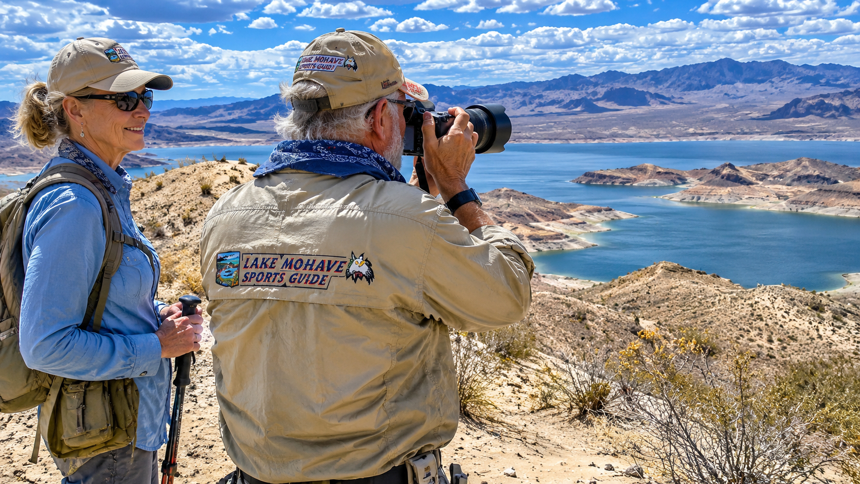
Hiking Fisherman's Trail at Katherine Landing: A Morning Adventure Along Lake Mohave
By Pat | Lake Mohave Outdoor Adventures
There's something mighty pleasant about sitting outside with a hot cup of coffee on a cool Arizona morning, watching the sun come up over the Black Mountains.
This morning at Casa Codorniz, the sky was particularly beautiful.
The rising sun was painting delicate pink wisps across a scattering of broken clouds. The desert mountains were beginning to emerge from their nighttime shadows, and the air had that wonderful freshness we enjoy during our winter months above Lake Mohave.
Paulette and I have watched countless sunrises from our little place on the western slopes of the Black Mountains, but I don't believe I've ever seen two exactly alike.
Sometimes the entire sky turns crimson.
Sometimes the clouds glow golden.
And sometimes, like this morning, the sunrise is a quiet affair, with just enough pink and lavender to remind a fellow to stop what he's doing and appreciate the view.
As I sipped my coffee, I began thinking about a little hiking trail near Katherine Landing Marina.
Fisherman's Trail.
I'd known about it for years.
I'd driven past the area countless times on our way to launch the boat.
But somehow, between fishing, photography, exploring desert trails in the Rhino, and the ordinary chores of maintaining Casa Codorniz, I'd never gotten around to hiking it.
Well, this morning seemed as good a time as any.
I mentioned the idea to Paulette.
Naturally, she was chomping at the bit.
That's one of the things I love about her. After more than four decades together, she's still ready to grab her hiking shoes and head out to see what's over the next hill.
So we gathered our cameras, drinking water, and a few necessities, loaded up the Cherokee, and headed downhill toward Katherine Landing.
We weren't planning anything ambitious.
Just a short morning hike.
A few photographs.
Maybe some video.
And back home in time for lunch.
As it turned out, Fisherman's Trail offered a few surprises.
Some were beautiful.
Others reminded this old fellow that a trail doesn't have to be long to demand a little respect.
Leaving Casa Codorniz for Katherine Landing Marina
Our winter home sits roughly five miles uphill from Lake Mohave, with the blue water of the Colorado River about 1,700 feet below us.
From the higher country around Casa Codorniz, we enjoy spectacular views across the lake toward the mountains of Nevada.
Spirit Mountain, known to the Mojave people as Avi Kwa Ame, dominates part of the western landscape.
Farther north, the Colorado River winds through a series of magnificent desert canyons.
It's a remarkable place to spend the winter.
After seventeen wonderful years in the mountains at Angel Fire, New Mexico, Paulette and I have come to appreciate the advantages of trading snowshoes for hiking boots and a snow shovel for a fishing rod.
As we drove down toward Katherine Landing, the morning sunlight illuminated the rocky slopes and scattered desert vegetation.
Creosote bushes.
Mesquite.
Cacti.
Little patches of desert grass.
And those wonderfully rugged mountains that seem to change color with every passing hour.
I've spent a lifetime enjoying the outdoors, beginning with my boyhood on cattle ranches in the Kansas Flint Hills.
But the desert has its own special appeal.
At first glance, it can appear almost barren.
Look a little closer, and you'll discover an extraordinary world of plants, wildlife, geology, and history.
That was what we were hoping to enjoy this morning.
A Twenty-Foot Mountain of Sand at the Boat Ramp
When we arrived at Katherine Landing Marina, I was surprised to discover that a recent monsoon storm had left behind a rather impressive calling card.
Near the top of the boat launch ramp stood an enormous pile of sand and sediment.
I'd estimate it was twenty feet high and forty feet long.
A small mountain.
And not one that belonged there.
Several weeks earlier, heavy monsoon runoff had apparently washed an extraordinary amount of material down toward the marina.
Now, numerous workmen and pieces of heavy equipment were busy around the area.
From what I could see, they appeared to be working on the drainage system and dealing with the accumulated sediment.
I couldn't help but stop and take a look.
Having spent seventeen years operating a construction business, I still find heavy equipment and construction projects interesting.
But this was also a vivid reminder of something I've learned during our years in Arizona.
Never underestimate a desert thunderstorm.
A dry wash can remain quiet for months.
Then a powerful storm arrives, sometimes miles away, and suddenly enormous quantities of water, sand, gravel, and rock begin moving downhill.
The desert doesn't need a river running through it every day to move mountains.
It just needs the occasional cloudburst.
The National Park Service warns that monsoon storms can produce flash flooding, road washouts, and hazardous conditions throughout Lake Mead National Recreation Area. It also advises visitors to check current boat-launch conditions because sediment, construction, and changing water levels can affect access.
National Park Service
The mountain of sand we saw was a remarkable illustration of those forces at work.
After satisfying my curiosity, we continued south from the boat ramp.
Our hiking adventure was waiting.
Finding the Fisherman's Trail Trailhead
We followed the road south and found a small parking area roughly a quarter mile from the trailhead.
It was a convenient place to leave the Cherokee.
We gathered our equipment, checked that we had water, and started walking.
Before long, we came upon a sign marking Fisherman's Trail.
There it was.
After years of wondering about this little trail, we were finally going to see where it led.
Fisherman's Trail is a short hiking route in the Katherine Landing area, generally described as leading toward Turkey Cove, a sheltered cove on Lake Mohave.
A local trail description places the walk at less than a mile to the cove, although that doesn't necessarily mean every section is easy or that shoreline access is always clear.
Lake Mead Launch
I wasn't interested in setting any hiking records.
At eighty-something, I've reached an age where I measure a successful hike by the enjoyment it provides, not the speed at which I finish it.
We started along the trail, enjoying the morning sunshine.
The route initially crossed several small hills.
Nothing particularly steep.
Nothing that looked especially challenging.
But it didn't take long to discover that Fisherman's Trail had a few tricks up its sleeve.
A Short Trail With Some Treacherous Footing
Now, I've spent a good portion of my life walking through rough country.
Growing up on Kansas ranches, I learned to watch where I stepped.
Later, Paulette and I spent years exploring the mountains around Angel Fire, hiking through forests, climbing rocky trails, and wandering across alpine meadows.
I've crossed mountain streams, climbed loose slopes, and negotiated more than a few trails that required careful attention.
So I wasn't expecting a short desert trail near a marina to present much difficulty.
But Fisherman's Trail had other ideas.
Several sections were covered with loose, scree-like gravel.
The small stones rolled beneath our boots, making the footing unexpectedly slippery.
And beneath that loose material were sharp, angular rocks.
Exactly the sort of rocks a fellow wouldn't want to land on.
I found myself thinking that the trailhead sign could use an additional warning.
Attention, senior citizens: Short trail, but watch your footing!
Not that younger hikers are immune to falling.
But when you've accumulated eight decades of birthdays, you begin to appreciate the value of keeping your knees, hips, and other important equipment in good working order.
A tumble onto sharp desert rocks could turn a pleasant morning outing into something considerably less enjoyable.
We slowed down.
Watched every step.
And worked our way carefully through the rougher sections.
I would describe the trail as short but uneven, with several places that deserve caution.
A trail's mileage tells only part of the story.
Its surface can be every bit as important as its distance.
My Advice for Senior Hikers on Fisherman's Trail
If you're an older hiker considering Fisherman's Trail at Katherine Landing, I would recommend sturdy hiking shoes with good traction, trekking poles, and a willingness to slow down whenever the footing becomes uncertain.
Avoid rushing downhill.
Loose gravel can behave like tiny ball bearings beneath your boots.
Keep your hands free when negotiating rocky sections.
And if a particular stretch looks uncomfortable, there's no shame in turning around.
I've reached an age where I no longer feel compelled to prove anything to a mountain.
The mountain has been there for millions of years.
It can wait.
From Rocky Hills to Beautiful Desert Sand Dunes
After crossing the small hills, the character of the trail changed dramatically.
The rocky ground gave way to a sandy pathway.
And suddenly, we found ourselves surrounded by beautiful desert dunes and sandy hills rising perhaps a hundred feet above the trail.
What a contrast!
Only a short distance earlier, we'd been picking our way across loose gravel and sharp rock.
Now we were walking through a soft, sandy landscape with gentle curves, warm colors, and beautiful textures.
The dunes and sandy slopes created a completely different atmosphere.
The morning sunlight emphasized the ridges and hollows.
Small plants clung to the sandy ground.
And the surrounding hills formed a natural enclosure that made the trail feel wonderfully secluded.
I stopped several times to photograph the scene.
The contrast between the pale sand and the darker volcanic mountains was particularly attractive.
It's one of the things I enjoy most about exploring the Lake Mohave region.
You never know what sort of landscape might be waiting around the next bend.
One moment you're crossing rocky desert.
The next you're walking between sand-covered hills.
And somewhere beyond those hills lies the brilliant blue water of Lake Mohave.
Paulette was enjoying herself.
So was I.
This was exactly the sort of little adventure we'd hoped to find.
The Trail Ends in a Thicket Near Turkey Cove
Eventually, the obvious trail began to fade.
The sandy pathway narrowed.
Vegetation became thicker.
And before long, we found ourselves facing a dense patch of brush near the end of a cove.
That was as far as the clear route took us.
Somewhere beyond the brush was the shoreline.
I could see how a determined hiker might continue through the vegetation to reach the water.
But that would involve a little bushwhacking.
And the desert isn't particularly forgiving when it comes to thorny plants.
Mesquite and other desert shrubs can make a simple shortcut considerably more unpleasant than expected.
I looked at the brush.
Looked at Paulette.
And decided the shoreline could wait for another day.
We'd already enjoyed a beautiful walk.
We'd taken photographs.
We'd recorded video.
And we'd discovered a trail we'd been curious about for years.
No need to turn a pleasant morning into a wrestling match with desert vegetation.
Besides, the brush might conceal loose rocks, animal burrows, or other obstacles.
Sometimes discretion is the better part of adventure.
We turned around and began retracing our steps.
Does Fisherman's Trail Reach the Water?
Published descriptions identify Turkey Cove as the trail's destination, but on our outing, the clearly visible footpath ended in heavy brush before we reached the shoreline.
That doesn't necessarily mean the route is permanently blocked. Trail conditions and vegetation can change, and other hikers may find an established continuation.
I can only describe what we encountered that morning.
For visitors, I'd recommend asking National Park Service staff or checking current local trail information before assuming the entire route is clear.
And I wouldn't recommend forcing a path through dense brush simply to reach the water.
There are plenty of beautiful places around Lake Mohave where shoreline access is much easier.
Back to Casa Codorniz for Lunch
The return hike gave us another opportunity to enjoy the sandy hills and rugged desert scenery.
We took our time across the loose gravel sections.
Stopped for a few more photographs.
And eventually made our way back to the Cherokee.
It had been a short outing.
But a satisfying one.
We'd discovered something new practically in our own backyard.
After loading the cameras, we headed back uphill toward Casa Codorniz.
Five miles later, we were home.
Just in time for lunch.
As I transferred the photographs and video to my computer, I found myself thinking about how fortunate Paulette and I have been.
After all these years together, we still enjoy discovering new places.
We don't need an elaborate expedition.
We don't need to travel hundreds of miles.
Sometimes all it takes is a cup of coffee, a beautiful sunrise, and the decision to explore a little trail we've been passing for years.
And that brings me to something else worth discussing.
For visitors who haven't experienced Lake Mohave, Fisherman's Trail is only one small part of a remarkable outdoor recreation area.
Lake Mohave: A Magnificent Stretch of the Colorado River
Lake Mohave occupies one of the most beautiful sections of the lower Colorado River.
The reservoir extends from Hoover Dam southward to Davis Dam, where the river continues past Laughlin, Nevada, and Bullhead City, Arizona.
Unlike many reservoirs formed by damming tributary rivers, Lake Mohave is essentially a long, narrow section of the Colorado River itself.
Its principal water supply comes from Colorado River releases through Hoover Dam, with smaller contributions from local runoff and intermittent desert washes.
Those washes may remain dry for much of the year, but as our morning visit to Katherine Landing demonstrated, they can carry extraordinary amounts of sediment during monsoon storms.
How Big Is Lake Mohave?
According to the National Park Service, Lake Mohave has the following approximate characteristics:
|
Lake characteristic |
Description |
|---|---|
|
Surface area |
28,084 acres |
|
Shoreline |
309 miles |
|
Average depth |
85 feet |
|
Maximum depth |
165 feet |
|
Principal inflow |
Colorado River through Hoover Dam |
|
Downstream boundary |
Davis Dam |
|
States |
Arizona and Nevada |
National Park Service
The reservoir is commonly described as stretching approximately 67 miles, although published measurements vary depending on the endpoints used.
The upper lake includes narrow canyon reaches with relatively cold water.
Farther south, the reservoir broadens into beautiful open water, rocky shorelines, and numerous coves.
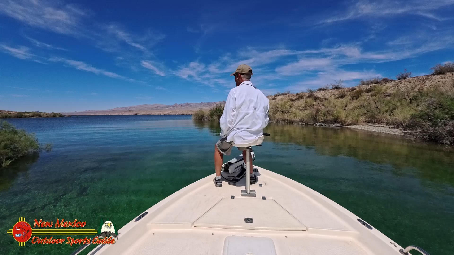
The lower lake near Katherine Landing offers some of our favorite winter fishing.
And that extraordinary water clarity is one of the things that keeps drawing us back.
What About Lake Mohave Water Levels?
Lake Mohave is managed as part of the Colorado River reservoir system.
Its water elevation changes with upstream releases, downstream water deliveries, and operational requirements.
Those fluctuations affect shoreline access, boat ramps, shallow hazards, and the depth of submerged structure.
I never assume that a familiar underwater rock or shoreline feature will be at exactly the same depth on my next fishing trip.
For current conditions, I recommend the Arizona Game and Fish lake-level resources, which link to Bureau of Reclamation information for the lower Colorado River reservoirs.
I also check National Park Service alerts and conditions before launching.
The mountain of sand we encountered at Katherine Landing is a good reminder that boat-ramp conditions can change even when the lake's overall elevation remains relatively stable.
Marinas and Boat Ramps on Lake Mohave
Lake Mohave has three principal developed marina destinations: Katherine Landing, Cottonwood Cove, and Willow Beach.
Each offers a different experience.
Katherine Landing Marina and Boat Ramp
Address: 2690 E. Katherine Spur Road, Bullhead City, AZ 86429
Telephone: 928-754-3245
Website: Katherine Landing Marina
Email: No general public email address independently verified. Use the marina's official contact page.
Katherine Landing is the southernmost major marina on Lake Mohave and the one Paulette and I visit most often.
It offers boat launching, fuel, boat rentals, marina slips, camping, lodging, and visitor services.
The National Park Service also identifies fishing access, swimming areas, and picnic facilities at Katherine Landing.
Katherine Landing+1
For us, it's practically the neighborhood marina.
Cottonwood Cove Resort and Marina
Address: 10000 Cottonwood Cove Road, Searchlight, NV 89046
Telephone: 855-918-5253
Website: Cottonwood Cove Resort
Email: Contact through the resort's official website; a current general email address was not independently confirmed.
Cottonwood Cove is located on the Nevada side of Lake Mohave.
It's a convenient destination for boaters who want to explore the central portion of the lake.
The resort offers a marina, launch facilities, fuel, boat rentals, lodging, camping, and RV accommodations.
National Park Service
Willow Beach Marina
Address: 25804 Willow Beach Road, Willow Beach, AZ 86445
Telephone: 855-918-5253
Website: Willow Beach Harbor
Email: Contact through the official website; a current public general email address was not independently confirmed.
Willow Beach provides access to the northern portion of Lake Mohave and the Colorado River below Hoover Dam.
This is spectacular canyon country.
The water can be noticeably colder than the lower lake.
Visitors enjoy fishing, kayaking, canoeing, and sightseeing.
The marina offers boat rentals, fuel, camping, and other services.
National Park Service
Other Lake Mohave Launching Opportunities
Additional access points include Princess Cove near Katherine Landing and designated shoreline launching areas such as Telephone Cove, where conditions and vehicle suitability permit.
Not every shoreline launch is suitable for a large bass boat.
Some are intended primarily for smaller craft or paddleboards and kayaks.
Always check current access restrictions and launch conditions before towing a boat down an unfamiliar road.
Where to Stay Near Katherine Landing
Visitors who want to explore Fisherman's Trail, fish Lake Mohave, or enjoy a few days in the desert have several lodging options.
Katherine Landing Lodge and Campground
Address: 2690 E. Katherine Spur Road, Bullhead City, AZ 86429
Telephone: 928-754-3245
Website: katherinelanding.com
Email: Use the website's contact form.
This is the most convenient choice for visitors who want to stay close to Fisherman's Trail and the marina.
The area offers motel accommodations, tent camping, and RV facilities.
Harrah's Laughlin Beach Resort & Casino
Address: 2900 South Casino Drive, Laughlin, NV 89029
Telephone: 702-298-4600
Website: Harrah's Laughlin
Email: Use the hotel's official reservation and contact channels; no general public email was verified.
Harrah's is located across the Colorado River from Bullhead City.
Paulette and I know it well.
When the pressure pump on our Casa Codorniz water system failed, we spent three nights there while waiting for repairs.
It's a comfortable alternative for visitors who prefer a hotel to camping.
Additional Laughlin Accommodations
Laughlin offers numerous hotels, restaurants, and visitor services within convenient driving distance of Katherine Landing.
I recommend the Laughlin tourism website for additional lodging options.
For a fishing vacation, I would choose accommodations based on boat-trailer parking, early departure convenience, and proximity to the launch ramp.
Those details matter more to me than a fancy lobby.
Weather: When Is the Best Time to Hike Fisherman's Trail?
For hiking, my favorite months around Katherine Landing are generally October through April.
Winter brings pleasant daytime temperatures, cool mornings, and beautiful light for photography.
Spring can also be wonderful, although windy days are common.
Summer is another matter.
Temperatures around Lake Mohave can exceed 110°F.
There is very little shade along exposed desert trails.
And the combination of heat, dry air, and physical exertion can quickly become dangerous.
The National Park Service emphasizes that desert weather can vary considerably throughout the recreation area and that visitors should prepare for extreme heat and rapidly changing conditions.
National Park Service
Hiking Safety and Equipment
For a short hike like Fisherman's Trail, I recommend carrying more water than you think you'll need, wearing sturdy footwear, and using sun protection.
My preferred equipment includes a small daypack, trekking poles, a charged phone with offline maps, a first-aid kit, and a camera.
I also recommend telling somebody where you're going.
A short trail can still be dangerous if you slip and injure yourself.
And don't underestimate loose gravel.
That was the principal hazard Paulette and I encountered.
Photographing and Filming Fisherman's Trail
Fisherman's Trail offers several interesting photographic opportunities.
The rocky hills near the beginning provide texture and contrast.
The sandy sections are especially attractive in morning light.
And the surrounding mountains make beautiful backgrounds.
I enjoy using a wide-angle lens for landscapes and a telephoto lens for wildlife.
For video, I look for scenes with movement.
A raven crossing the sky.
Wind moving through desert vegetation.
Cloud shadows sliding across the mountains.
Or Paulette walking ahead along the trail.
I prefer natural colors and realistic lighting.
The desert is beautiful enough without artificial exaggeration.
For recreational drone photography, visitors should remember that launching, landing, or operating drones within Lake Mead National Recreation Area generally requires specific National Park Service authorization.
I wouldn't launch a drone from Fisherman's Trail without first confirming that the activity was permitted.
Wildlife Along Fisherman's Trail
The desert around Katherine Landing supports an interesting variety of wildlife.
Gambel's quail are among my favorites.
They also happen to be the reason I named our winter home Casa Codorniz.
We frequently see coveys around the house.
Their distinctive calls and entertaining behavior are part of our daily routine.
Other wildlife in the Lake Mohave region includes ravens, roadrunners, red-tailed hawks, desert cottontails, jackrabbits, coyotes, and desert bighorn sheep.
Desert tortoises may also occur in suitable habitat.
The National Park Service specifically identifies Gambel's quail, roadrunners, and desert tortoises among the wildlife hikers may encounter in the Katherine Landing area.
National Park Service
Rattlesnakes are another reason to watch where you step.
I never reach blindly into rocks or brush.
And I always photograph wildlife from a respectful distance.
For additional information about Arizona wildlife and habitat conservation, I recommend the Arizona Game and Fish Department.
Fishing Lake Mohave: Largemouth and Smallmouth Bass
Although Fisherman's Trail was our destination this morning, I can't write about Lake Mohave without talking about bass fishing.
After all, I've spent much of my life chasing largemouth and smallmouth bass.
From guiding fishermen on Lake Conroe to competing in professional bass tournaments across Texas, I've enjoyed a wonderful relationship with this sport.
And Lake Mohave has become one of my favorite places to fish.
The Arizona Game and Fish Department identifies Lake Mohave as a high-priority warmwater fishery for largemouth and smallmouth bass, while also recognizing striped bass, channel catfish, and native fish conservation as important management considerations.
Arizona Wildlife Conservation Strategy
Where Do Largemouth Bass Live in Lake Mohave?
Largemouth bass generally prefer cover.
In Lake Mohave, I look for protected coves, aquatic vegetation where present, submerged brush, rocky points, and shallow flats near deeper water.
The lake doesn't have the extensive standing timber found in many Texas reservoirs.
Instead, rock formations, submerged ledges, vegetation patches, and changes in bottom contour become especially important.
Aquatic vegetation can provide shade, ambush cover, and habitat for baitfish.
But vegetation distribution changes with water levels, seasonal conditions, and location.
I never assume that every cove will contain a productive weed bed.
Where Do Smallmouth Bass Live?
Smallmouth bass are particularly fond of rocky habitat.
I look for boulder fields, gravel transitions, rocky points, ledges, and submerged shelves.
They often hold near depth changes.
On a clear-water lake, that might mean fishing considerably deeper than a newcomer expects.
During winter, bass may use depths of 20 to 40 feet or more, depending on water temperature, forage, and conditions.
During the spawning season, suitable shallow gravel and rock areas become especially important.
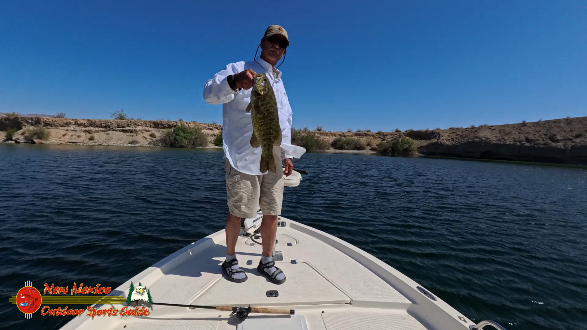
Smallmouth bass are wonderful fighters.
And there's nothing quite like watching a big bronzeback come up from the clear water to investigate a lure.
My Favorite Lake Mohave Bass Fishing Equipment
For finesse fishing, I prefer a medium-light or medium spinning rod, approximately seven feet long, with a quality spinning reel and light braided line connected to a fluorocarbon leader.
For larger swimbaits, spinnerbaits, and crankbaits, a medium-heavy baitcasting outfit is useful.
Natural lure colors often work well in Lake Mohave's clear water.
Green pumpkin.
Watermelon.
Brown.
Smoke.
Translucent shad.
And subtle baitfish patterns.
When the water is stained after runoff or wind, darker silhouettes and brighter accents may become more effective.
The trick is matching the presentation to the conditions.
And sometimes, after trying everything in the tackle box, the fish still refuse to cooperate.
That's fishing.
Lake Mohave Bass Fishing Month by Month: January Through December
The following is my seasonal fishing approach based on decades of bass fishing, Lake Mohave's clear-water habitat, and general Arizona Game and Fish guidance about bass behavior.
These are starting patterns, not guarantees. Water temperature, current, wind, forage, and seasonal weather determine where the fish actually hold.
January: Winter Bass Fishing
January is usually a time for patience.
I concentrate on rocky points, steep ledges, and deeper water adjacent to protected coves.
For smallmouth bass, I begin searching in approximately 20 to 40 feet, sometimes deeper.
My favorite presentations include 3- to 4-inch drop-shot worms, small finesse jigs, and 2.5- to 3.5-inch swimbaits.
Green pumpkin, smoke, and natural shad colors are good starting choices.
Largemouth may hold near deeper vegetation edges, rock transitions, and protected structure.
Slow presentations are usually more productive than racing a lure through cold water.
February: Early Prespawn Movement
As the days grow longer, bass begin responding to gradual warming.
I look for points leading into spawning coves, rocky secondary points, and sheltered shorelines.
Smallmouth may begin moving shallower during extended warm periods.
I like suspending jerkbaits in the 3.5- to 4.5-inch range, finesse jigs, and small swimbaits.
For largemouth, a 4- to 6-inch soft-plastic worm worked slowly near cover can be effective.
Water temperature matters more than the calendar.
March: Smallmouth Bass Become More Active
March can be a wonderful month on Lake Mohave.
Smallmouth bass begin using shallower rocky areas as conditions become favorable.
I search gravel points, protected pockets, and rocky flats near deeper water.
Depths of 5 to 20 feet may become productive.
My favorite lures include 3-inch tubes, 3- to 4-inch swimbaits, Ned rigs, and finesse jigs.
Natural crawfish colors and green pumpkin are excellent choices.
Largemouth begin exploring protected spawning areas as well.
April: Prime Spring Bass Fishing
April is one of my favorite months.
Depending on water temperatures and local conditions, bass may be spawning, preparing to spawn, or recovering afterward.
This is when sight fishing can become particularly exciting.
I look for protected coves with suitable gravel, rock, and firm bottom.
Smallmouth often use rocky spawning areas.
Largemouth may prefer protected pockets with vegetation or other cover.
A small finesse worm, tube, or lightly weighted soft plastic can be effective.
I take special care with spawning fish, avoiding unnecessary disturbance and releasing fish promptly.
May: Postspawn Feeding
As spring progresses, many bass begin moving away from spawning areas.
Some remain shallow.
Others move toward nearby points, ledges, and deeper structure.
I look for smallmouth around rocky points and drop-offs in approximately 10 to 25 feet.
For largemouth, vegetation edges and shaded pockets can be productive.
Small swimbaits, crankbaits, finesse worms, and topwater lures during low-light periods are worth trying.
This is also a good time to watch for baitfish activity.
June: Early Summer Patterns
June brings warmer weather and increasing recreational boat traffic.
I prefer fishing early in the morning.
Smallmouth may hold around deeper rocky structure during the day.
Largemouth often use shade, vegetation, and protected cover.
A drop-shot rig or finesse jig can work well in deeper water.
During early morning or evening, I may try a walking topwater lure or popper.
Shad-colored lures are useful when bass are feeding on baitfish.
July: Deep Water and Early Morning Fishing
July can be brutally hot.
I avoid the midday heat whenever possible.
My fishing usually begins before sunrise.
Smallmouth may use deeper points, ledges, and boulder fields.
Largemouth often relate to available shade, cover, and vegetation.
I fish 3- to 5-inch finesse worms, drop-shot rigs, and small swimbaits.
Depths of 20 to 40 feet can be useful starting points, but I rely on electronics and actual fish activity rather than a fixed depth.
And I carry plenty of drinking water.
August: Summer Bass Fishing
August often continues the summer pattern.
Early morning and late afternoon are generally my preferred fishing periods.
I search rocky points, submerged shelves, and areas holding baitfish.
When bass are actively feeding, a small topwater lure or swimbait can be exciting.
During slower periods, I return to finesse presentations.
For largemouth, I look for vegetation edges and sheltered cover.
Summer monsoon storms can develop quickly, so weather awareness is especially important.
September: The Beginning of Fall Transition
September can be an interesting month.
The weather gradually begins changing, although temperatures may remain very warm.
Bass may start moving with baitfish as seasonal conditions shift.
I look for rocky points, coves, and underwater structure near deeper water.
Small crankbaits, swimbaits, jerkbaits, and finesse worms can all produce.
When baitfish are concentrated, I pay particular attention to nearby points and ledges.
October: Fall Feeding Opportunities
October is one of my favorite months to be on Lake Mohave.
The weather becomes more comfortable.
Boat traffic often moderates.
And bass may feed actively as conditions change.
I look for smallmouth along rocky points, boulder fields, and submerged ledges.
Depths of 10 to 30 feet are useful starting areas.
Crankbaits, jerkbaits, swimbaits, and finesse jigs can be productive.
For largemouth, I search protected coves and vegetation edges.
October also provides wonderful opportunities for wildlife photography.
November: Cooling Water and Slower Presentations
As water temperatures fall, bass may begin moving toward winter habitat.
I concentrate on deeper points, ledges, and rocky structure.
Smallmouth can remain active, but their preferred depth and feeding behavior may change.
I often begin with a drop-shot rig, finesse jig, or small swimbait.
For largemouth, I search protected areas near deeper water.
The key is slowing down and paying attention to the fish.
December: Winter Fishing Returns
December brings cooler mornings and generally quieter conditions on the lake.
I enjoy this time of year.
There's something wonderful about launching the boat on a crisp winter morning while much of the country is dealing with snow and ice.
I look for smallmouth on deeper rocky structure.
Largemouth may hold near protected cover and depth changes.
Finesse worms, drop-shot rigs, and small jigs are my preferred presentations.
And when the fishing slows down, I simply enjoy the scenery.
After all, a morning on Lake Mohave is rarely wasted.
Lake Mohave Bass Fishing: Quick Seasonal Reference
|
Season |
Smallmouth habitat |
Largemouth habitat |
Productive lure choices |
|---|---|---|---|
|
Winter |
Deep rocky points and ledges |
Protected structure near deep water |
Drop-shot, finesse jig, small swimbait |
|
Spring |
Gravel flats and rocky spawning areas |
Sheltered coves and vegetation |
Tubes, worms, jerkbaits, finesse plastics |
|
Summer |
Deeper rock, shelves, baitfish concentrations |
Shade, cover, vegetation edges |
Drop-shot, swimbait, topwater |
|
Fall |
Points, boulders, baitfish routes |
Cove mouths, vegetation, structure |
Crankbait, jerkbait, jig, swimbait |
These patterns are consistent with the Arizona Game and Fish Department's general bass-habitat guidance, which emphasizes aquatic vegetation, submerged cover, and drop-offs for largemouth bass.
Arizona Game & Fish Department
For additional habitat research, the department provides Lake Mohave reservoir fish-habitat location files.
Lake Mohave Fishing Records: Some Remarkable Fish
Lake Mohave has produced some impressive catches.
The Nevada Department of Wildlife's published lake-record summary through 2023 lists:
|
Species |
Lake-record weight |
Angler |
Date |
|---|---|---|---|
|
Largemouth bass |
11 lb |
H. P. Warner |
March 7, 1972 |
|
Smallmouth bass |
7 lb 6 oz |
Tim Myers |
March 16, 2019 |
|
Striped bass |
63 lb |
Allan S. Cole |
March 15, 2001 |
|
Rainbow trout |
16 lb 4 oz |
Mike Soskin |
December 15, 1971 |
|
Channel catfish |
26 lb 4 oz |
Keith Rannebarger |
July 6, 1978 |
Clark County, NV
These are historical Lake Mohave records, not necessarily current Arizona or Nevada statewide records. I have not independently confirmed whether any lake-specific records have been surpassed since that published summary.
The 63-pound striped bass remains especially noteworthy because Nevada continues to list it as its state record.
eRegulations
Arizona Game and Fish also maintains an official Arizona state fish records database.
A Word About Current Fishing Regulations
Lake Mohave is a shared Arizona-Nevada waterway, and anglers should verify the current licensing, bag-limit, and interstate-water provisions before fishing.
In February 2026, Arizona Game and Fish announced changes aligning Lake Mead and Lake Mohave striped bass and catfish limits with Nevada's regulations. The striped bass daily bag limit became unlimited, and the catfish daily bag limit became 25.
Arizona Game & Fish Department
Those changes don't eliminate the need to check current bass limits, protected species regulations, or other fishing requirements.
I always recommend checking the latest rules before heading onto the water.
Driving to Fisherman's Trail at Katherine Landing
Katherine Landing is located near Bullhead City, Arizona, just north of Davis Dam.
The following are approximate one-way driving distances to the Katherine Landing area. Actual mileage depends on your starting address, traffic, and route.
|
Starting city |
Approximate distance |
General route |
|---|---|---|
|
Las Vegas, Nevada |
105–115 miles |
US-95 south to Searchlight, NV-163 east toward Laughlin, then into Bullhead City |
|
Flagstaff, Arizona |
180–200 miles |
I-40 west to Kingman, then US-93/AZ-68 toward Bullhead City |
|
Phoenix, Arizona |
225–245 miles |
US-60 west and US-93 northwest toward Kingman, then AZ-68 |
|
Tucson, Arizona |
340–370 miles |
I-10 west toward Phoenix, then US-93 and AZ-68 |
|
Bakersfield, California |
300–330 miles |
CA-58 east toward Barstow, I-40 east to Needles, then US-95 north |
|
Los Angeles, California |
300–330 miles |
I-15 east toward Barstow, I-40 east to Needles, then US-95 north |
Once in Bullhead City, follow the signs toward Katherine Landing via Katherine Spur Road.
For Fisherman's Trail, continue to the appropriate trailhead area south of the marina. The exact parking arrangement should be confirmed locally, particularly if maintenance or construction is underway.
Five More Lake Mohave Adventures Worth Exploring
One of the pleasures of maintaining the Lake Mohave website is sharing stories that help visitors discover the many different sides of this remarkable reservoir.
For readers interested in exploring beyond Fisherman's Trail, here are five related articles from the Lake Mohave website.
Our story about Shoshone Cove on Lake Mohave explores another beautiful shoreline destination north of Princess Cove, with opportunities for fishing and enjoying the desert scenery.
For anglers who appreciate the lake's remarkable clarity, Bass Fishing the Jade Green Clear Water of Lake Mohave provides another look at the experience of fishing these beautiful waters.
Those interested in the region's background can explore Lake Mohave History, including the reservoir's development and recreational opportunities.
If you're just getting started with bass fishing, Beginner Bass Fishing on Lake Mohave offers useful information about basic tackle, techniques, and developing your skills.
And for a broader understanding of how bass respond to changing conditions, Bass Seasonal Movement explains the importance of water temperature, seasonal habitat changes, and lure presentation.
All five links lead to existing articles on lake-mohave.com. The site's XML sitemap could not be opened directly, so I verified these article URLs individually.
Why a Little Trail Can Make a Wonderful Morning
As I sit here at Casa Codorniz looking through the photographs from our Fisherman's Trail adventure, I'm reminded of something I've learned during a lifetime spent outdoors.
You don't always have to travel far to discover something worthwhile.
I've flown airplanes across the country.
Guided fishermen on some of the finest bass lakes in Texas.
Hiked the mountains of New Mexico.
Explored remote desert trails.
And photographed wildlife in places that required considerable planning just to reach.
But sometimes, a little trail five miles from home can provide just as much enjoyment.
This morning began with a cup of coffee and a beautiful sunrise.
A few pink wisps of cloud drifting across the sky.
A spontaneous suggestion.
And Paulette, as usual, ready to go.
We found our way to Katherine Landing.
Discovered a mountain of sand left by the monsoon.
Walked across rocky hills with some rather treacherous footing.
Enjoyed a beautiful sandy landscape surrounded by dunes.
And eventually reached a thicket of desert brush that persuaded us to save the shoreline for another day.
Nothing particularly dramatic.
No mountain summit.
No record-breaking fish.
No grand expedition.
Just a pleasant morning exploring a little corner of the Arizona desert.
And you know something?
That's enough.
At eighty-something, I've learned that the most valuable adventures aren't necessarily the longest or the most difficult.
They're the ones that leave you smiling when you get home.
The ones you share with somebody you love.
The ones that give you a few photographs, some pleasant memories, and another story to tell.
Paulette and I have been fortunate to share more than four decades of adventures together.
And I hope we have plenty more ahead.
There are still trails we haven't explored.
Coves we haven't visited.
Mountains we haven't photographed.
And more than a few smallmouth bass in Lake Mohave that haven't met my fishing rod.
As for Fisherman's Trail?
We'll be back.
Perhaps next time we'll find a clear way through to the shoreline at Turkey Cove.
Or perhaps we'll simply enjoy the sandy hills again and turn around when we've had enough.
Either way, we'll take our cameras.
We'll carry plenty of water.
And we'll watch our footing.
Because there's one thing I've learned about hiking in the desert.
A trail doesn't have to be long to be an adventure.
And sometimes, the best part of the whole outing is getting back to Casa Codorniz in time for lunch.

0 Comments