
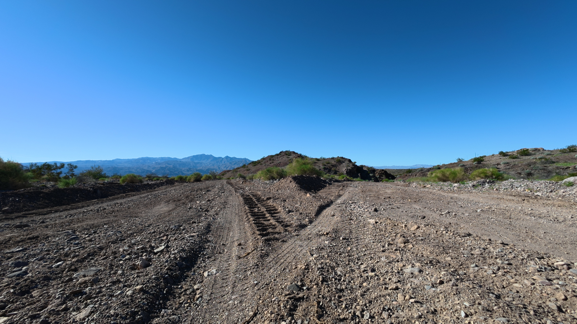
In the rugged Black Mountains of northwestern Mohave County, Arizona, a network of historic jeep trails and washes has long provided residents and visitors with access to old mine workings, desert scenery, and recreational opportunities near Lake Mohave and the boundaries of Lake Mead National Recreation Area. One of those routes, Old Wagon Trail (with associated Route designations such as 7741 and connections toward the Tyro area), has for years functioned as a relatively narrow, unimproved track suitable for high-clearance vehicles. Local accounts describe it as having retained essentially the same character for more than a decade and a half.
Recent first-hand documentation by a nearby resident raises questions about the scale, methods, and oversight of current mineral exploration activity in the vicinity. The account details observations of paint markings on natural rock formations, apparent sample collection associated with claim stakes, the presence of a recognized prospector’s vehicle on private property, heavy-equipment grading that widened trails into broader roads, and resulting changes to drainage patterns that could increase erosion toward residential areas. These observations are set against the publicly documented expansion of exploration by West Point Gold Corp. on its Gold Chain Project, which includes the historic Tyro Mine area and surrounding BLM and patented claims.
This post compiles the reported observations in chronological order, places them in the context of the company’s public disclosures and the regulatory framework governing mining claims and surface operations on public lands, and notes the proximity of the activity to residential subdivisions and the national recreation area. The intent is factual reporting of available information and regulatory standards rather than accusation. Independent verification by the relevant agencies remains essential.
Setting and Observed Sequence of Events
Old Wagon Trail provides access from the vicinity of Katherine Mine Road and Lake Mohave View Ranchos (also referred to locally in variations such as Mohave Lake View Ranchos) toward the Tyro Mine area and beyond. The subdivision itself consists of a small cluster of one-acre tracts developed decades ago on land with historical ties to railroad holdings, offering views toward Lake Mohave. Residents have used the surrounding washes and trails for recreation, including walks that once featured observations of desert wildlife such as tortoises and coyotes near abandoned workings.
According to the resident’s documentation, the sequence began with reports of paint defacement on natural rock formations along Route 7739. While traveling Old Wagon Trail and Route 7741 in the morning hours (around 10:00 a.m.), the observer noted that road and trail conditions remained consistent with long-standing jeep-trail standards. At the driveway of a part-time neighbor’s property at 5022 Old Wagon Trail Road, fresh tire tracks were visible. Proceeding up the approximately quarter-mile driveway to greet the occasional visitors, the observer instead found a tan Toyota Tundra pickup—recognized as belonging to the lead prospector—parked beside the cabin. A man was seated in the driver’s seat. The vehicle carried California license plate #####Z$. The resident chose not to confront the individual, citing concerns over the intensity of prior prospecting activity, and instead recorded video of the truck before continuing.
Further along the route, paint markings were located on natural rock formations at two sites. Claim stakes and rock fragments consistent with sampling were present in the same locations. Video documentation was made of these features. The observer then returned home.
Later the same afternoon, around 3:00 p.m., heavy equipment noise was audible from the direction of the intersection of Old Wagon Trail and Trout Place, adjacent to the residence. A large road grader—described as resembling equipment used by the county on Katherine Mine Road—had been stopped by neighbor Don at that intersection. As the resident began recording from the side of the house facing Trout Place, neighbor Dan approached. Upon seeing the raised camera, the grader operator raised the blade and departed quickly down Trout Place and then Davis Way, followed by a late-model dark-colored pickup whose driver shielded his face.
According to the account relayed by Don, the grader operator stated an intention to grade through Mohave Lake View Ranchos to the Old Wagon Trail blacktop at the southwest corner of the subdivision and indicated that grading had already been completed all the way from the Tyro Mine. When asked for a copy of a permit, the operator reportedly replied that none existed.
Subsequent inspection by Don and the resident of the freshly graded road from Tyro showed that where Old Wagon Trail leaves the Lake Mohave View Ranchos area, the downhill side had been cut deeply enough to leave a 12- to 24-inch berm. This configuration would direct runoff from the adjacent 400-foot ridge down the road itself and into Trout Place in front of the residence, rather than into the downhill wash. No drainage structures (such as shutes or water bars directing flow off the road) were observed. The newly graded alignment extended Route 7862 (the Tyro mine trail) without strict adherence to the prior trail alignment and without apparent provisions for runoff mitigation.
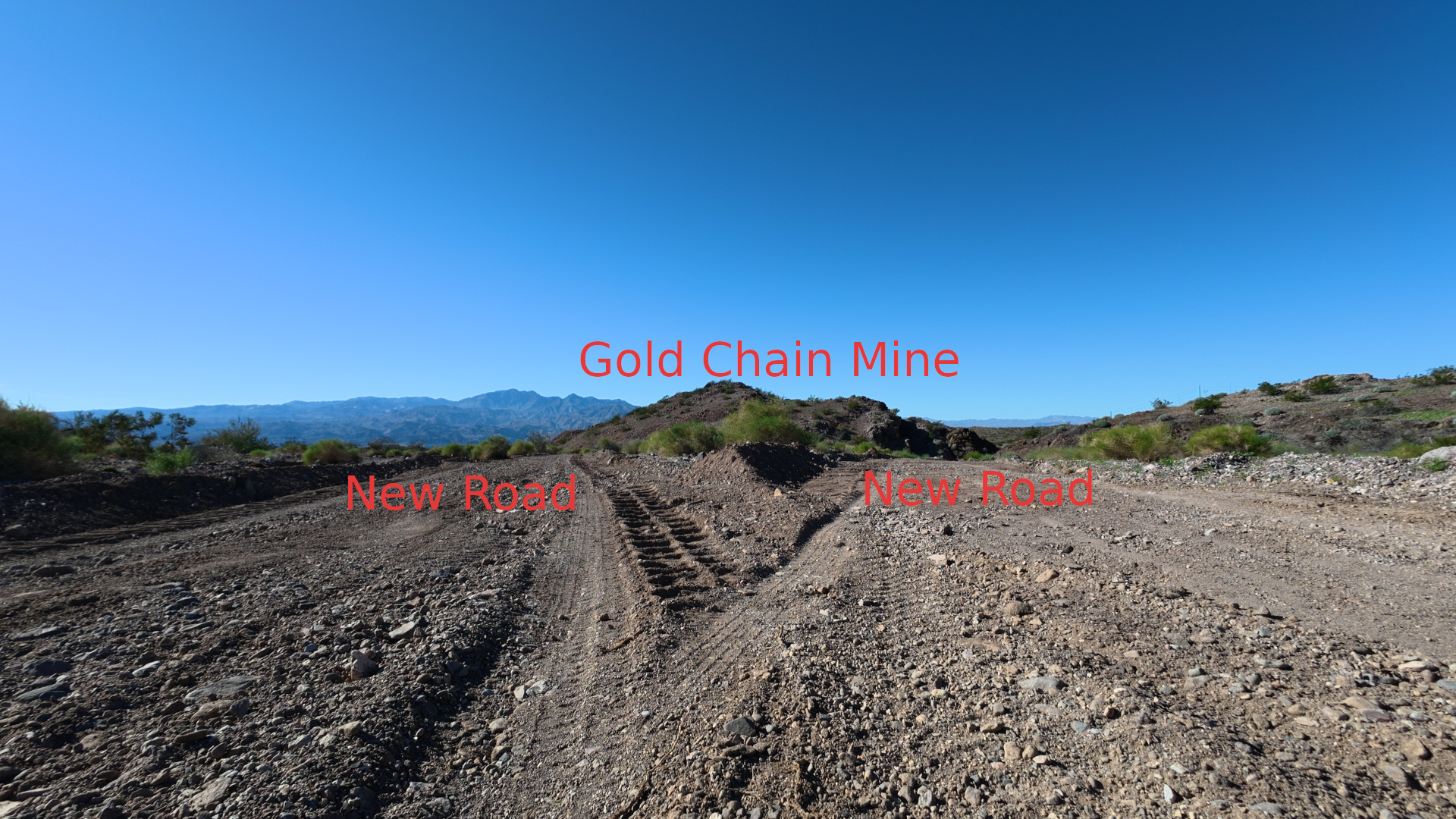
On the return trip, additional recent grading was noted on a road constructed the previous year that leads down to and encircles the Gold Chain Mine, as well as on the jeep trail running from the west end of Gold Chain Mine northward over the ridge to the Old Ranch ruins and into the wash.
The resident’s primary stated concern is the apparent absence of visible government-agency supervision and the possibility of limited or absent permitting or development planning for increasingly aggressive cutting of new routes and regrading of existing BLM trails, including reported use of private vacation property. The cumulative effect described is the conversion of a once-narrow approximately six-mile scenic trail from Old Wagon Trail to the Tyro Mine into a roughly 20-foot-wide dirt road, and the transformation of a previously more pristine wash around the Gold Chain Mine—used by residents for family walks and storytelling about local wildlife—into a newly graded approximately 15-foot-wide road. Thousands of claim stakes are said to now litter the landscape in multiple directions.
West Point Gold and the Gold Chain Project
West Point Gold Corp. (TSX.V: WPG; OTCQX: WPGCF; FSE: LRA0) is a Vancouver-based exploration company focused on gold projects along the Walker Lane Trend in Arizona and Nevada. Its flagship is the Gold Chain Project in Mohave County, Arizona, situated in the historic Oatman / Union Pass / Katherine mining district within the Black Mountains.
Public disclosures describe the project as encompassing hundreds of BLM lode claims (reports have cited figures in the range of 492 to 614 claims covering several thousand hectares) plus 15 patented claims covering roughly 114 hectares. These include the Tyro, Banner, and Sheep Trail claim groups, among others. The company has conducted extensive drilling, reported high-grade intercepts at the Tyro Main Zone and Northeast Tyro Zone (including intervals such as multi-tens of meters at multi-gram-per-tonne gold grades), and advanced toward a maiden resource estimate. Additional targets include Black Dyke, Bull 8, Sheep Trail, and the Frisco Graben area. Recent activity includes expansion of the claim package, royalty buybacks to simplify ownership on certain claims, and planning for substantial additional meterage of drilling.
Company materials characterize the system as a large-scale low-sulfidation epithermal gold occurrence with mineralization open along strike and at depth. Exploration targets have been publicly discussed in conceptual terms (for example, ranges of tens of millions of tonnes at multi-gram grades at Tyro), with the explicit caveat that such figures are conceptual and require further definition. The company has referenced receipt of permits, including a Plan of Operations allowing deeper drilling at Tyro Main and Northeast Tyro.
Historic mines in the broader district, including Gold Chain and Tyro, have long records in geological literature. The Gold Chain Mine (also associated with names such as Gold Chain group, Black Dike, etc.) is documented as a former gold occurrence with underground workings and some identified resources of low-grade material in older assessments.
Proximity matters for context. One compilation places the Tyro Mine roughly 3.75 miles from Lake Mead National Recreation Area. Claim stakes and exploration activity nearer the Lake Mohave View Ranchos area and along Old Wagon Trail bring surface disturbance closer to residential use and the recreation-area boundary.
Regulatory Framework for Mining Claims and Surface Operations
Unpatented mining claims on BLM-managed public land are located under the General Mining Law of 1872. Claimants have rights to explore for and develop locatable minerals, subject to federal surface-management regulations. Key provisions appear in 43 CFR Part 3809 (surface management) and related occupancy rules under 43 CFR 3715.
Operations are categorized by intensity:
- **Casual use** involves minimal disturbance (no mechanized earth-moving in most cases) and generally requires no notice or plan.
- **Notice-level** operations cover exploration that exceeds casual use but stays under defined thresholds (generally ≤5 acres of disturbance, limited bulk sampling). A notice must be filed with the local BLM office, include maps of access routes, describe equipment and reclamation, and be accompanied by a financial guarantee. Operations may begin after a waiting period if BLM does not object, but performance standards still apply.
- **Plan of Operations** is required for larger disturbance, bulk sampling above thresholds, or operations in certain special-status areas. The plan must detail the full proposed activity, access routes, water management, reclamation, and measures to prevent unnecessary or undue degradation. BLM review includes environmental analysis under NEPA, public comment opportunities, and potential consultation. Approval is required before operations begin.
Performance standards under 43 CFR 3809.420 specifically address access routes: they “shall be planned for only the minimum width needed for operations and shall follow natural contours, where practicable to minimize cut and fill.” Where cuts exceed three feet on the inside edge, consultation with the authorized officer may be required. Operators are entitled to reasonable access, but the authorized officer may require use of existing roads to minimize new routes. Reclamation to applicable standards is mandatory, backed by financial guarantees.
Occupancy of public land under mining claims is restricted to activities “reasonably incident” to mining. Unauthorized residential or non-mining use can trigger enforcement.
Private property is outside the scope of mining-claim rights. Entry onto private land without permission constitutes trespass under state law, independent of federal mining regulations. County road-maintenance equipment operating on private or non-county routes would ordinarily require appropriate authorization; an operator’s reported statement that no permit existed, if accurate, would raise separate questions for county and BLM review.
Paint markings on rocks and claim stakes are common claim-marking practices, but defacement that goes beyond lawful claim monuments or sample identification can raise separate issues under land-management rules or state statutes protecting natural features. Drainage changes that concentrate runoff onto private property or public roads can create civil liability and may violate performance standards requiring prevention of unnecessary or undue degradation, including erosion control.
Arizona and BLM guidance emphasize that significant alteration of existing trails (for example, converting a jeep track into a substantially wider graded road) can exceed the scope of certain historic rights-of-way and requires coordination. Routine maintenance that preserves the status quo is treated differently from conversion that increases the burden on the land.
Environmental and Community Implications
The resident’s documentation highlights several practical consequences: conversion of narrow scenic trails into wider dirt roads; creation of berms that redirect slope runoff onto residential access routes; absence of observed drainage mitigation; densification of claim stakes across the landscape; and reported loitering or staging on private vacation property. These changes affect recreational use, visual character, potential wildlife habitat (including areas where desert tortoises have been observed), and the risk of accelerated erosion in a steep, arid environment subject to intense thunderstorm runoff.
From an investment or project-advancement perspective, sophisticated evaluation of mining projects routinely considers not only the in-ground resource but also social license, permitting risk, environmental liabilities, and community relations. Red flags that increase cost and risk include unresolved surface-use conflicts, inadequate erosion controls, private-property disputes, proximity to sensitive federal lands such as national recreation areas, and questions about the completeness of notices or plans of operations relative to observed ground disturbance. A buyer examining a data room for claims in the Gold Chain area would reasonably inquire into the status of all surface-disturbance authorizations, financial guarantees, reclamation bonding, drainage designs, and any complaints or enforcement actions recorded by BLM, Mohave County, or the National Park Service (for Lake Mead NRA).
The historic Oatman and surrounding districts produced significant gold in earlier eras. Modern exploration can generate economic activity and, if successful and properly permitted, eventual production. At the same time, the public lands surrounding Lake Mohave View Ranchos and the approaches to Tyro and Gold Chain serve residential, recreational, and conservation values. The Mining Law framework balances mineral development against the prevention of unnecessary or undue degradation; the practical question is whether observed activities remain within the scope of authorized notices or plans and whether mitigation measures are being implemented on the ground.
Path Forward and Oversight
Residents who document apparent unauthorized activity on public or private land are typically directed to report specifics—dates, locations, photographs or video, vehicle descriptions, and license plates—to the appropriate BLM field office with jurisdiction over the claims, to Mohave County authorities for private-property or road issues, and, where proximity to the recreation area is relevant, to Lake Mead National Recreation Area administration. BLM maintains procedures for investigating unauthorized use and for enforcing surface-management and occupancy regulations.
West Point Gold’s public disclosures indicate active permitting and drilling programs aimed at resource definition. Independent confirmation that all graded routes, claim-related surface work, and any occupancy fall within approved notices or plans of operations, and that reclamation and drainage standards are being met, would address many of the concerns raised. Conversely, any gaps between authorized activities and observed ground disturbance would require corrective action under the regulations.
The desert landscape east of Lake Mohave retains both mineral potential and significant public and private values. Sustained, transparent oversight by the responsible agencies is the mechanism designed to ensure that exploration proceeds in a manner consistent with the law and with the long-term condition of the land.
Sources and Further Reading
1. West Point Gold corporate disclosures and project pages describing the Gold Chain Project, claim holdings, drill results, and permitting references (westpointgold.com and associated news releases).
2. Mindat.org locality pages for Gold Chain Mine and Tyro Mine, Mohave County, Arizona.
3. BLM surface-management regulations, 43 CFR Part 3809, including §§ 3809.11, 3809.21, 3809.401, 3809.420 (access routes and performance standards).
4. BLM occupancy regulations, 43 CFR Subpart 3715.
5. BLM Arizona operator information guidance on casual use, notice, and plan-level operations.
6. Arizona Attorney General opinion and related discussion of R.S. 2477 rights-of-way and limits on trail conversion.
7. Local and topographic references to Old Wagon Trail, Lake Mohave View / Mohave Lake View Ranchos, and proximity of Tyro Mine to Lake Mead National Recreation Area.
8. Diggings.com and USGS-derived mine location data placing Tyro approximately 3.75 miles from Lake Mead NRA.
9. Historic mining-district literature for the Union Pass / Katherine / Oatman area.
Readers are encouraged to consult primary BLM and company filings for the most current status of specific notices, plans of operations, and claim records. The observations summarized here are those of a local resident; definitive determinations of compliance rest with the administering agencies.


0 Comments